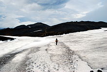
Fimmvorđuhals (Fimmvörduháls) Eruption Site
Fimmvorđuhals (Fimmvörduháls) Eruption Site
Duration: 9 hours return trip. Difficulty: tough hike with 850m of ascent and descent. A short knife-edge ridge will challenge anyone who suffers vertigo. Do not attempt the walk in high winds or bad visibility. Check the forecast before setting out and be wary of leaving the marked trail if cloud descends. Interest: a superb mountain hike with jaw-dropping views, taking you to the March 2010 eruption site. Start/End: park by the hut at Basar and leave your name and intended route with the warden.
From Basar take the track through the birch scrub and over the stony gravel flats of the plain for about 15 minutes until you cross a small stream by a footbridge. Just the other side of the stream the path to Fimmvorduhals and Skogar should be signposted. The trail climbs gently through woodland, emerging into the open above the gorge Strákagil under an eroded bluff.
Soon you will reach a broad grass and moss slope which climbs steadily. Eventually, this narrows to a knife-edge ridge with steep drops to either side. A short section is very narrow and special care is needed. Once this is out the way the route heads towards the cliffs of Morinsheidi Plateau, steadily climbing a gentle slope.
Once upon the plateau, it is worth detouring to the east side for a view of the glaciers. Back on the trail across the plateau and in due course the trail dips down to a saddle called Heljarkambur, with steep drops to either side. A fixed chain is in place to help you over the next slightly tricky section. The trail continues to climb gently and soon you will have the craters and new lava from the March 2010 eruption in sight.


