Lakagigar (Lakagígar) the Laki Craters
Lakagigar (Lakagígar) the Laki Craters
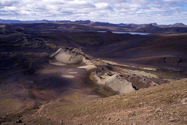
The impressive row of 100 craters was formed in a volcanic eruption along a 25 km long fissure, starting in June 1783 and lasting seven months. The eruption produced the biggest lava flow in historical times and is considered among the ten most damaging eruptions in historical times.
What set Laki apart was that the eruption was accompanied by toxic gases that killed over 75% of Iceland's livestock. This lead to extreme hardship and famine that caused the death of a fifth of the island’s population. The eruption also had an impact in Europe causing a drop in global temperatures, resulting in widespread crop failures and famine.
The craters are regarded as a globally unique phenomenon and have been protected as a natural monument since 1971. Nature here is very fragile, especially the moss that now covers the craters, so it is absolutely essential to stick to the marked paths.
In the centre of the row stands the 818m high Laki mountain, visibly split by the fissure. In the parking area at the foot of the mountain you will find toilets and marked walking trails. The shortest walk takes about 20 minutes and the longest about 2-3 hours. You can continue the drive to a second parking area where there is another very scenic trail that winds through the lava to a crater with a stunning cobalt-blue lake in it.
The road (F206) to the craters is a 4WD road, rough and rugged in parts with some rivers to cross; allow two hours each way and note that there are no facilities other than basic toilet. Ensure you have enough fuel and bring food and drink with you.
On the way, pause by Geirlandsá river, to view the aptly named Fagrifoss waterfall, which means ‘Beautiful Falls’, contrasting greatly with the rugged and desolate scenery in its surrounds. Fagrifoss is 24km from the start of road F206. All off-road driving is strictly forbidden here as elsewhere in Iceland.


