Sprengisandur highland route
Sprengisandur highland route
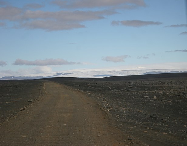
Sprengisandur is the name given to the highland route F26, which traverses the island's uninhabited interior from south to north. The dirt road is only passable to high-clearance four-wheel drive vehicles.
The route described here is based on traveling from Fludir in the south to Myvatn in the north.
An early start is essential as it is both long (approx. 400km), and rather slow going, mostly on gravel tracks. By allowing at least 12 hours, you will have time to enjoy the views and make ample stops en route.
You will also need to take supplies; when setting off from the south, Hrauneyjar, a small fuel station, guesthouse, and cafe is the last place to stock up on food and fuel.
It was built originally to house workers during the construction of the first of four hydroelectric power stations, their intake flow provided by powerful glacial rivers.
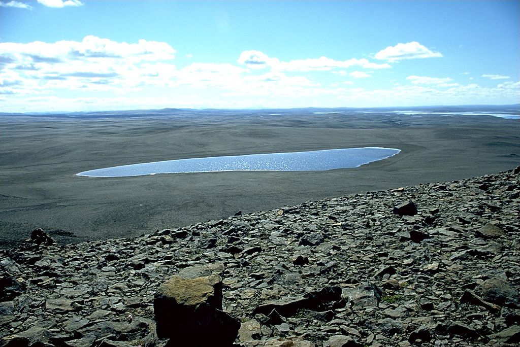
For the first 100-110km the track winds over glacial moraines, left behind when the last ice sheets retreated from the area 10,000 years ago.
If you’re lucky with the weather, you may get magnificent views of Vatnajokull icecap to the east and Hofsjokull to the west. Take a short detour to Kistualda and enjoy a far-reaching view towards the glaciers.
The mountain hut at Nyidalur, situated near the base of the mountain Tungufellsjokull, is a popular stop.
A charge is made to use the toilets so have some coins handy to put in the box. Many wildflowers grow in the river valley here, including the large pink blooms of arctic river beauty, a species of willow herb.
Before setting off again, we recommend asking the warden for information about the condition of the rivers ahead including the Nyidalsa by the hut, which is wide and braided with several sandy islets.
Get out and check the location of the ford, taking note that any poles in the river bed are there to guide you.
If in doubt, wait until other cars arrive and cross, so you can see how deep it is. Don’t stop while driving through the water as the river has a sandy bottom and if you stop, it is easy to get stuck.
As with all rivers, enter in a low gear and proceed slowly and steadily. It’s also better to cross when others are around, in case you have trouble and need assistance. Read the instructions with your vehicle’s documentation before you tackle the river.
The next river is Fjordungskvisl, which can be anything from a small stream to a dangerous torrent with a stony, uneven bottom, depending on recent weather conditions.
Again, wait to see how others fare before crossing. Drive through slowly because the stones on the bottom can be quite large.
Once over this river, you'll cross the Sprengisandur plain. The name translates as 'Explosion Sands', perhaps an obscure reference to the effort horses and riders had to endure when they crossed the bare expanse of volcanic ash and glacial sediment.
Next you'll follow the course of a small river past bright patches of luminous green moss splashed over the hillside. The road rises to broad moraine ridges with distant views of the Dyngjufjoll range, shapely Herdubreid and the crater Trolladyngja to the east.
Soon you will notice Skjalfandafljot, a powerful glacial river flowing in a gorge east of the road. Take time to stop at the waterfall Aldeyjarfoss, a short detour off the road. There are toilets at the car park. Though the waterfall is neither high nor powerful, the columnar lava formations that surround it give it a magical setting.
Finally, as the route heads down the Bardardalur Valley, farms come into view and you will arrive at the junction with road 1, near the service station and waterfall at Godafoss.
Practical Information: The route is long – 400km – allow 12 hours. Fill up at Hrauneyjar before you set off and take a packed lunch and drinks.


