Storurd (Stórurð) hike
Storurd (Stórurð) hike
Duration: 5 hours. Difficulty: moderately strenuous. There are a couple of steep sections on the path and some streams to ford. Ascent and descent of around 250m. Interest: mountain views, birds, flora, boulders the size of houses, a beautiful turquoise lake. Start/End: marked by a sign on the sharp left-hand bend as road 94 climbs towards the Vatnsskarð saddle (no.4 on the map).
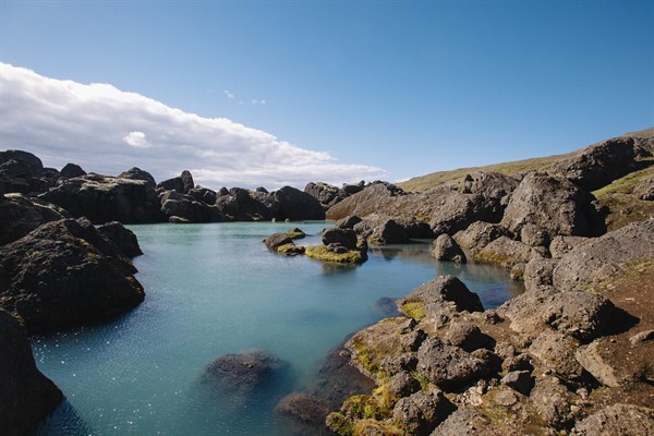
The first 5km are a bit of a slog as the path contours around the base of a ridge above a valley with several small streams to cross. This path is numbered 13 on the map. As the giant boulders of Storurd come into view, a side trail (no.3) takes off to the right, making a circular walk through this massive landslide that probably fell at the end of the Ice Age, forming the mountain’s ‘door’. You will reach a small turquoise lake amongst the boulders, a good spot for a picnic.
From here, cross the stream and make your way up the steep slope in front of you, which leads shortly afterwards to a trail junction (no.2 on the map). You now bear left and north along the flank of the hill on trail 14, eventually climbing to the crest of a broad ridge, from where you have good views to either side. Descend to meet the road at the saddle of Vatnsskard (no.1 on the map) then follow the road left back down to where you left your car.


